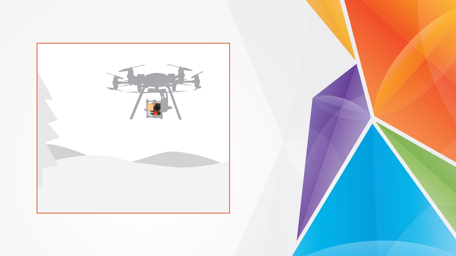
AIRBORNE HYPERSPECTRAL IMAGING SOLUTIONS FOR UAVs AND MANNED AIRCRAFT FOR PRECISION REMOTE SENSING
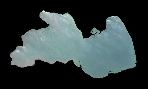
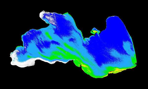
HUMAN EYE / RGBHYPERSPECTRAL

Airborne hyperspectral imaging, also called as remote sensing, captures both spectral and spatial information as the sensor moves through flight paths. The result is a georeferenced hyperspectral data cube ready for analysis—covering entire landscapes with pixel-level chemical detail. High-resolution airborne hyperspectral data enables efficient large-scale mapping, environmental monitoring, and precision agriculture.

SPECIM AFX

Compact all-in-one solution for hyperspectral remote sensing

AISA SYSTEMS

Complete hyperspectral product family dedicated to airborne and defense use

BENEFITS OF AIRBORNE HYPERSPECTRAL IMAGING

Airborne hyperspectral imaging uses drones or aircraft to capture detailed spectral information from the ground. By recording hundreds of narrow wavelengths for every pixel, it creates a “spectral fingerprint” of materials allowing to identify vegetation types, minerals, water quality, and other features that standard cameras cannot see. With airborne deployment on drones or aircraft, hyperspectral imaging enables:

  • CAPTURE RICH DATA AT SCALE
    Survey large areas efficiently with high spectral and spatial resolution.

  • REVEAL INVISIBLE INFORMATION
    Detect chemical and biological variations, water quality markers, and pollution that cannot be seen with traditional sensors.

  • ENABLE EARLY INTERVENTION
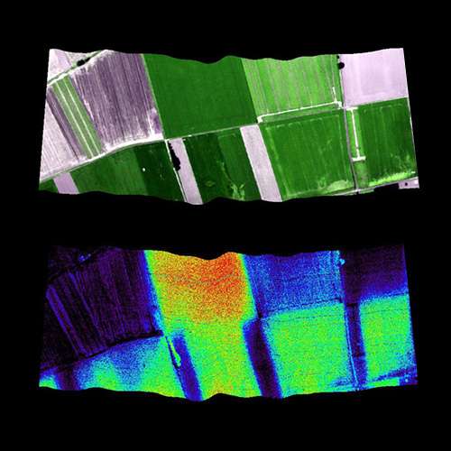
    Identify crop stress, nutrient deficiencies, disease, or environmental change before visible symptoms appear.

  • IMPROVE DECISION-MAKING
    Access accurate spectral data for modeling, forecasting, operational planning, and long-term environmental monintoring.

Airborne hyperspectral image - Fluorescence

SPECIM SOLUTIONS FOR UAV AND AIRBORNE HYPERSPECTRAL IMAGING:

Hyperspectral imaging systems

Specim offers complete high-performing airborne hyperspectral imaging systems designed for both manned and unmanned platforms.

Specim AFX10 Hyperspectral Camera For Drones

Specim AFX10

VNIR (400–1000 nm)

Specim AFX17 Hyperspectral Camera For Drones

Specim AFX17

NIR (900–1700 nm)

AisaFENIX Airborne Hyperspectral Camera

AisaFENIX

VNIR (380-970 nm)
SWIR (970-2500 nm)

Data processing tool

CaliGeo PRO

CaliGeo PRO

AIRBORNE HYPERSPECTRAL IMAGING APPLICATIONS

Airborne hyperspectral imaging supports a wide range of professional remote sensing applications. From monitoring crop stress before it becomes visible to mapping vegetation species, detecting pollution events, or supporting geological surveys, airborne HSI provides the actionable information needed for confident decision-making.

Environmental monitoring

Environmental monitoring

Agriculture and vegetation

Mining and Mineral Exploration with Hyperspectral Imaging Solutions

Geology and mining

WHY CHOOSE SPECIM

Specim has decades of experience in hyperspectral imaging, supporting demanding airborne remote sensing projects across agriculture, environment, forestry, and geology. Whether you need a ready-to-fly UAV solution or high-performance sensors for your aircraft, Specim provides reliable and precise airborne HSI systems.

Specim provides:

  • Field-proven airborne hyperspectral sensors designed for stability and accuracy

  • All-in-one solutions for UAV for rapid deployment

  • High spectral quality and sensitivity required for scientific-grade surveys
  • Robust calibration ensuring data consistency over time
  • Global sales and technical support from experienced experts
UAV hyperspectral imaging

Ready to elevate your remote sensing capabilities?

Experience how airborne hyperspectral imaging delivers chemical-level insights from UAVs and manned aircraft.

LEARN MORE

Discover the Power of Airborne Hyperspectral Imaging with the Specim AFX

Discover the Power of Airborne Hyperspectral Imaging with the Specim AFX

Webinar: How to acquire HSI data from UAV?

Drone Hyperspectral Data Collection: How to Acquire Hyperspectral Imaging Data From UAV

Drone Hyperspectral Data Collection: How to Acquire Hyperspectral Imaging Data From UAV

Hyperspectral imaging in agriculture and vegetation

Mining and Mineral Exploration with Hyperspectral Imaging Solutions

Hyperspectral imaging for mining and mineral exploration

Hyperspectral imaging for environmental monitoring